CONDITIONS DE VENTE
La vente se fera au comptant en euros. Les acquéreurs paieront en sus des enchères par lot et par tranche, les frais et taxes suivants :
Jusqu’à 150 000 € : 24% HT, soit 25,32 % TTC pour les livres et 28,80% TTC pour les manuscrits, autographes, estampes et tableaux
De 150 001 à 500 000 € : 20,50% HT soit 21.6275 TTC pour les livres et 24,60% TTC pour les manuscrits, autographes, estampes et tableaux
Et au delà de 500 001 € 17% HT soit 17.935% TTC pour les livres 20,40% TTC pour les manuscrits, autographes, estampes et tableaux
Les enchères suivent l’ordre des numéros du catalogue.
La Société de Vente et les Experts se réservent la faculté, dans l’intérêt de la vente, de réunir ou de diviser les numéros du catalogue.
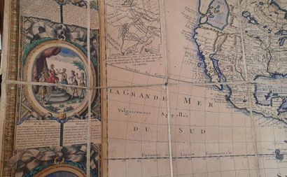
Les dimensions et poids des oeuvres sont donnés à titre indicatif.
CATALOGUE
Nous avons notifié l’état des objets dans la mesure de nos moyens, il est mentionné au catalogue à titre strictement indicatif. Les biens sont vendus dans l’état où ils se trouvent au moment de la vente. L’absence de mention dans le catalogue, n’implique nullement que le lot soit en parfait état de conservation ou exempt de restauration.
Les dimensions et poids des oeuvres sont donnés à titre indicatif. Une exposition ayant permis un examen préalable des pièces décrites au catalogue, il ne sera admis aucune réclamation concernant l’état de celles-ci, une fois l’adjudication prononcée et l’objet remis. Sur demande, un rapport de condition pourra être fourni pour les lots dont l’estimation est supérieure à 1 000 €. Les estimations sont fournies à titre purement indicatif. Les mentions concernant la provenance et/ou l’origine du bien sont fournies sur indication du vendeur et ne sauraient entraîner la responsabilité de l’OVV Binoche et Giquello. Conformément aux dispositions de l’article L321-17 du Code de commerce, l’action en responsabilité contre l’OVV se prescrit par 5 ans à compter de l’adjudication ou de la prisée.
ORDRES D’ACHATS
Tout enchérisseur qui souhaite faire une offre d’achat ou enchérir par téléphone peut envoyer sa demande par courrier, par mail ou par fax, à l’O.V.V. Binoche et Giquello, accompagnée de ses coordonnées bancaires et postales. Les enchères par téléphone sont un service gracieux rendu aux clients qui ne peuvent se déplacer. L’O.V.V. Binoche et Giquello et ses employés ne pourront être tenus responsables en cas d’erreur éventuelle ou de problème de liaison téléphonique. Lorsque deux ordres d’achat sont identiques, la priorité revient au premier ordre reçu. En cas d’adjudication, le prix à payer sera le prix marteau ainsi que les frais, aux conditions en vigueur au moment de la vente.
VENTES AUX ENCHÈRES EN LIGNE
Une possibilité d’enchères en ligne est proposée. Elles sont effectuées sur le site internet www.drouotlive.com, qui constitue une plateforme technique permettant de participer à distance par voie électronique aux ventes aux enchères publiques ayant lieu dans des salles de ventes. Le partenaire contractuel des utilisateurs du service Drouot Live est la société Auctionspress. L’utilisateur souhaitant participer à une vente aux enchères en ligne via la plateforme Drouot Live doit prendre connaissance et accepter, sans réserve, les conditions d’utilisation de cette plateforme (consultables sur www.drouotlive.com), qui sont indépendantes et s’ajoutent aux présentes conditions générales de vente.
ADJUDICATAIRE
I/L’adjudicataire sera le plus offrant et dernier enchérisseur pourvu que l’enchère soit égale ou supérieure au prix de réserve éventuel. Dans l’hypothèse où un prix de réserve aurait été stipulé par le vendeur, l’O.V.V. Binoche et Giquello se réserve le droit de porter des enchères pour le compte du vendeur jusqu’au dernier palier d’enchère avant celle-ci, soit en portant des enchères successives, soit en portant des enchères en réponse à d’autres enchérisseurs. En revanche le vendeur ne sera pas admis à porter lui-même des enchères directement ou par mandataire. Le coup de marteau matérialisera la fin des enchères et le prononcé du mot « adjugé » ou tout autre équivalent entraînera la formation du contrat de vente entre le vendeur et le dernier enchérisseur retenu. En cas de double enchère reconnue effective par le commissaire-priseur, le lot sera immédiatement remis en vente, toute personne intéressée pouvant concourir à la deuxième mise en adjudication. Dès l’adjudication, les objets sont placés sous l’entière responsabilité de l’acquéreur. Il appartiendra à l’adjudicataire de faire assurer le lot dès l’adjudication. Il ne pourra tenir l’O.V.V. Binoche et Giquello, responsable en cas de perte, de vol ou de dégradation de son lot.
II/TVA -Régime de la marge- biens non marqués par un symbole :
A/Tous les biens non marqués seront vendus sous le régime de la marge et le prix d’adjudication ne sera pas majoré de la TVA. La commission d’achat sera majorée d’un montant tenant lieu de TVA (20 % sauf pour les livres 5.5%) inclus dans la marge. Cette TVA fait partie de la commission d’achat et ne sera pas mentionnée séparément sur nos documents.
III/Lots en provenance hors UE sous le régime de l’admission temporaire : (indiqués par un Ɵ sur le catalogue et/ou annoncés en début de vente).
Aux commissions et taxes indiquées ci-dessus au début des conditions de ventes, il convient d’ajouter des frais additionnels de 5,5 % H.T. au prix d’adjudication ou de 20 % H.T. pour les bijoux et montres, les vins et spiritueux, les multiples et les automobiles, frais additionnels majorés de la TVA actuellement 20% (5.5% pour les livres).
IV /Conditions de remboursement des frais additionnels et de la TVA (cf : 7e Directive TVA applicable au 01.01.1995)
A/ Si le lot est exporté vers un État tiers à l'Union Européenne
Les frais additionnels ainsi que la TVA sur les commissions et sur les frais additionnels, peuvent être rétrocédés à l’adjudicataire non résident de l’Union Européenne sur présentation des justificatifs d’exportation hors UE pour autant qu’il ait fait parvenir à la sarl binoche et giquello l’exemplaire n°3 du document douanier d’exportation et que cette exportation soit intervenue dans un délai de deux mois à compter de la date de la vente aux enchères (passé ce délai, aucun remboursement ne sera possible). Binoche et Giquello sarl devra figurer comme expéditeur dudit document douanier.
B/ Si le lot est livré dans un État de l’UE
La TVA sur les commissions et sur les frais additionnels peut être rétrocédée à l’adjudicataire de l’Union Européenne justifiant d’un n° de TVA Intracommunautaire et d’un document prouvant la livraison dans son état membre sous réserve de la fourniture de justificatifs du transport de France vers un autre état membre, dans un délai d’un mois à compter de la date de la vente (passé ce délai, aucun remboursement ne sera possible).
PAIEMENT
L’adjudicataire a l’obligation de payer comptant et de remettre ses nom et adresse.
Le paiement du lot aura lieu au comptant, pour l’intégralité du prix, des frais et taxes, même en cas de nécessité d’obtention d’une licence d’exportation. En application des règles de TRACFIN, le règlement ne pourra pas venir d’un tiers. En cas de paiement par chèque non certifié, la délivrance des objets pourra être différée jusqu’à la garantie de l’encaissement de celui-ci. Un délai de plusieurs semaines peut être nécessaire. Les acquéreurs ne pourront prendre livraison de leurs achats qu’après un règlement bancaire. Les chèques tirés sur une banque étrangère ne seront autorisés qu’après accord préalable de la Société de Vente. Pour cela il est conseillé aux acheteurs d’obtenir, avant la vente, une lettre accréditive de leur banque pour une valeur avoisinant leur intention d’achat, qu’ils transmettront à la Société de Ventes. Paiement en espèces conformément au décret n°2010-662 du 16 juin 2010 pris pour l'application de l'article L.112-6 du code monétaire et financier, relatif à l'interdiction du paiement en espèces de certaines créances. Les bordereaux acquéreurs sont payables à réception. A défaut de règlement sous 30 jours, l’O.V.V. Binoche et Giquello pourra exiger de plein droit et sans relance préalable, le versement d’une indemnité de 40 euros pour frais de recouvrement (Art L 441-3 et Art L 441-6 du Code du Commerce).
A DÉFAUT DE PAIEMENT
Conformément aux dispositions de l’article L. 321-14 du Code de Commerce, à défaut de paiement par l’adjudicataire, après mise en demeure restée infructueuse, le bien sera remis en vente à la demande du vendeur sur folle enchère de l’adjudicataire défaillant ; si le vendeur ne formule pas sa demande dans un délai d’un mois à compter de l’adjudication, il nous donne tout mandat pour agir en son nom et pour son compte à l’effet, à notre choix, soit de poursuivre l’acheteur en annulation de la vente trois mois après la vente, soit de le poursuivre en exécution et paiement de ladite vente, en lui demandant en sus et dans les deux hypothèses tous dommages et intérêts, frais et autres sommes qui nous paraitraient souhaitables.
RETRAIT ET EXPÉDITION DES ACHATS
Sauf accord préalable avec l’acheteur, les objets volumineux et les meubles sont à retirer au magasinage de l’Hôtel Drouot. Les autres lots sont à retirer dans un délai de 15 jours dans les locaux de l’OVV Binoche et Giquello. Le délai passé, le stockage sera facturé 2 euros minimum par jour ouvré. Magasinage Drouot : Tout objet/lot demeurant en salle le lendemain de la vente à 10 heures, et ne faisant pas l’objet d’une prise en charge par la société de ventes, est stocké au service Magasinage de l’Hôtel Drouot. Accès par le 6bis rue Rossini – 75009 Paris. Ouvert du lundi au samedi de 9h à 10h et de 13h à 18h. Le service Magasinage est payant, à la charge de l’acquéreur. La tarification au 1er septembre 2016 est la suivante : Frais de dossier : 5 € HT. Frais de stockage et d’assurance : 1 € HT/jour, les 5 premiers jours ouvrés ; 5€/9€/16€ HT/jour, à partir du 6e jour ouvré, selon l’encombrement du lot. Une semaine de magasinage est offerte pour les clients de Drouot Transport. Le magasinage de l’Hôtel des ventes n’engage pas la responsabilité l’OVV Binoche et Giquello à quelque titre que ce soit. Pour toute expédition, un forfait minimum de 36 euros sera demandé.
BIENS CULTURELS
L’état français dispose d’un droit de préemption sur les oeuvres d’art ou les documents privés mis en vente publique. L’exercice de ce droit intervient immédiatement après le coup de marteau, le représentant de l’État manifestant alors la volonté de ce dernier de se substituer au dernier enchérisseur, et devant confirmer la préemption dans les 15 jours. La société binoche et giquello n’assume aucune responsabilité des conditions de la préemption par l’État français. L’exportation de certains biens culturels est soumise à ‘obtention d’un certificat de libre circulation pour un bien culturel. Les délais d’obtention du dit certificat ne pourront en aucun cas justifier un différé du règlement. L’O.V.V. Binoche et Giquello et/ou le Vendeur ne sauraient en aucun cas être tenus responsables en cas de refus dudit certificat par les autorités.